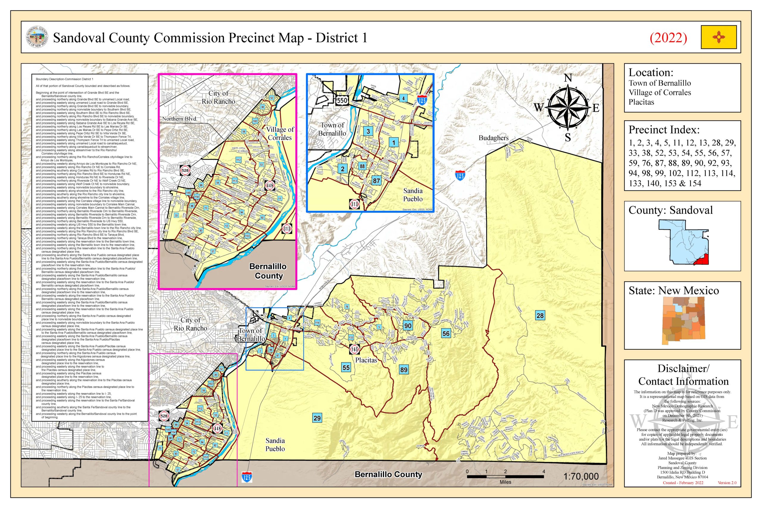
Serving the residents of the Town of Bernalillo, Village of Placitas, Eastern Rio Rancho, Algodones, Pueblo of Sandia, Budaghers, Santo Domingo, Pena Blanca, Town of Cochiti Lake and La Madera.
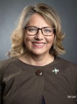
About Commissioner Katherine Bruch
After several visits to the Land of Enchantment via her husband’s family, Sandoval County Commissioner Katherine Bruch couldn’t wait to call New Mexico home.
Bruch said when her husband Frank Serrano began looking for a new job in 2011, New Mexico was high on his list of places to move to.
“We thought of this move as a preview to retirement and after deciding on the Placitas area and have loved living here ever since,” she said.
After making the move to Placitas, Bruch quickly began volunteering in the community, which helped her build relationships with the people that would soon become some of her constituents.
“I was part of the Placitas Community Library and a social organization that does community service like collecting food for the poor and organizing blood drives,” she said.
Bruch said she saw first-hand the gaps in District 1 and thought about the ways she might be able to help those in need.
“I thought with some of my experience in the corporate world, running a small business, and my volunteer experience, I could find a way to combine those skills to help the people in my district,” she said.
Bruch said she finds working on the Sandoval County Commission exhilarating and challenging.
“I know we don’t always have the answers but working on reaching those goals is part of the experience and is everything I expected it to be,” she said.
Bruch said her goal is to be able go out and find solutions that will work for her constituents in the long run.
District 1 Boundaries
Along | Direction | To |
---|---|---|
Beginning at the intersection of Santa Fe Hills Blvd and State Hwy 44 (Hwy 550) |
||
State Hwy 44 (Hwy 550) | Southeast | Santa Ana Pueblo Boundary |
Santa Ana Pueblo Boundary | East, North, West | San Felipe Pueblo Boundary and power line |
power line | West. North, and East | I-25 |
I-25 | Northeast | Arroyo de San Francisco |
Arroyo de San Francisco | South | San Felipe Pueblo Boundary |
San Felipe Pueblo Boundary | East, North | Santo Domingo Pueblo Boundary |
Santo Domingo Pueblo Boundary | West, North, East | Rio Grande |
Rio Grande | North | State Hwy 22 |
State Hwy 22 | North | Unnamed fence line |
Unnamed fence line | West | Unnamed stream |
Unnamed stream | South | Unnamed fence line |
Unnamed fence line | West | Unnamed ridge line |
Unnamed ridge line | Northwest | Unnamed gully |
Unnamed gully | Southwest | Unnamed stream |
Unnamed stream | North | Unnamed fence line |
Unnamed fence line | West | Unnamed stream |
Unnamed stream | North | Unnamed gully |
Unnamed gully | West | Unnamed ridge line |
Unnamed ridge line | Northwest | Cochiti Pueblo Boundary |
Cochiti Pueblo Boundary | North, East | Rio Grande |
Rio Grande | Northeast | Sandoval County Boundary |
Sandoval County Boundary | South, West | Albuquerque Riverside Drain |
Albuquerque Riverside Drain | North | Bernalillo Riverside Drain |
Bernalillo Riverside Drain | North | Corrales Main Canal |
Corrales Main Canal | West | Rio Grande |
Rio Grande | North | Arroyo de la Barranca |
Arroyo de la Barranca | West | Rio Rancho Blvd (Hwy 528) |
Rio Rancho Blvd (Hwy 528) | Northeast | Enchanted Hills Dr |
Enchanted Hills Dr | Northwest | Santa Fe Hills Blvd |
Santa Fe Hills Blvd | North | State Hwy 44 (Hwy 550) |
Ending at the intersection of Santa Fe Hills Blvd and State Hwy 44 (Hwy 550) |